GeoDataINRAE
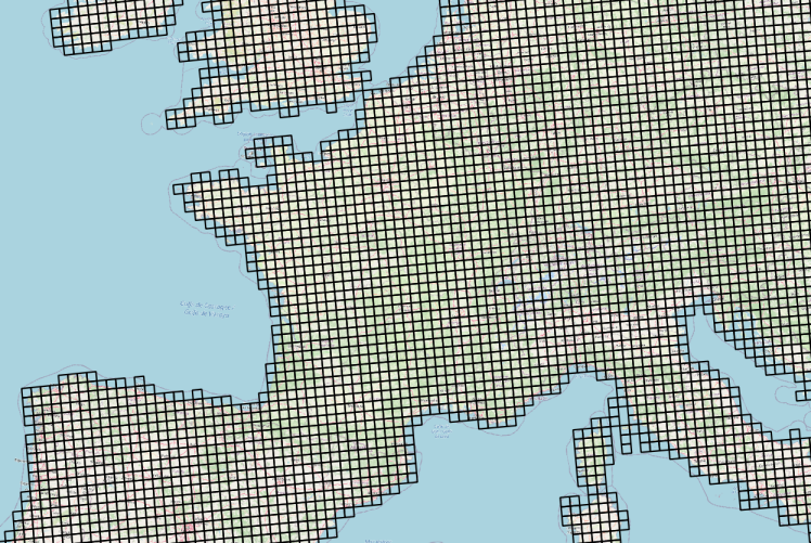
Grille de 25×25 km d'accès aux données météorologiques Agri4cast sur la France
Meteorological observations from weather stations interpolated on a 25x25 km grid in France
Données météorologiques Agri4cast basées sur des observations et spatialisées sous la forme d'une grille composée de mailles carrées de 625 km² (25 km ×25 km) sur la France.
La table attributaire de cette couche permet d'établir le lien entre l'objet géographique (la maille) et les chroniques d'observation météorologiques via un service conforme au standard OGC SensorThings ( https://frost.geosas.fr/agri4cast/v1.0/)
Les observations sont :
- température maximale de l'air (°C),
- température minimale de l'air (°C),
- température moyenne de l'air (°C),
- vitesse moyenne quotidienne du vent à 10 m (m/s),
- pression atmosphérique (hPa),
- précipitations cumulées (mm/jour),
- évapotranspiration potentielle d'un couvert végétal (mm/jour),
- rayonnement global total (KJ/m2/jour).
Les données météorologiques sont quotidiennes de 1979 à la dernière année civile révolue. Plus d’informations sur le portal Agri4cast : https://agri4cast.jrc.ec.europa.eu/DataPortal/Index.aspx
Meteorological observations from weather stations interpolated on a 25x25 km grid, on a daily basis from 1979 to the last calendar year completed, for France.
Meteorological observations are freely accessible via OGC SensorThings Standard service : https://frost.geosas.fr/agri4cast/v1.0/
Observed properties :
- maximum air temperature (°C),
- minimum air temperature (°C),
- mean air temperature (°C),
- mean daily wind speed at 10m (m/s),
- vapour pressure (hPa),
- sum of precipitation (mm/day),
- potential evapotranspiration from a crop canopy (mm/day),
- total global radiation (KJ/m2/day),
More informations on Agri4cast Resources Portal : https://agri4cast.jrc.ec.europa.eu/DataPortal/Index.aspx
Simple
-
Date (Publication)Date (Publication)
- 2022-06-22
-
ButPurpose
-
Ce service d'accès aux données météorologiques a été déployé pour simplifier leur intégration dans des modèles et des outils d'aide à la décision. L'idée motrice est de contribuer à la coconstruction d'un écosystème de services numériques pour la science ouverte basé sur les principes du FAIR data et de la directive INSPIRE.
This Meteorological data access service has been deployed to simplify their integration into models and decision support tools. The driving idea is the co-construction of an ecosystem of digital services for open science based on the principles of FAIR data and the INSPIRE directive.
-
ReconnaissanceCredit
-
Joint Research Centre de la Commission Européenne
Joint Research Centre of the European Commission
-
StatusEtat
-
On goingMise à jour continue
- Point of contact
-
Organisation name Individual name Electronic mail address Role UMR 1069 SAS INRAE - Institut Agro
UMR 1069 SAS INRAE - Institut Agro
Service GéoSAS
GéoSAS
DistributorDistributeur
- Keywords
-
-
données ouvertes
open data
-
-
GEMET - INSPIRE themes, version 1.0
-
-
Elevation
-
-
Access constraintsContraintes d'accès
-
Other restrictionsAutres restrictions
-
Autres contraintesOther constraints
-
Pas de restriction d'accès publicNo limitations to public access
-
Limitation d'utilisationUse limitation
-
Usage libre sous réserve des mentions obligatoires sur tout document de diffusion : "Source : Joint Research Centre of the European Commission"
Free use subject to mentioning the source : Source : Joint Research Centre of the European Commission
-
Limitation d'utilisationUse limitation
-
Licence ouverte V2.0. https://geosas.fr/metadata/pdf/ETALAB-Licence-Ouverte-v2.0.pdf
-
Use constraintsContraintes d'utilisation
-
LicenseLicence
-
Autres contraintesOther constraints
-
Pas de restriction d’accès public
No limitations to public access
-
Spatial representation typeType de représentation spatiale
-
VectorVecteur
-
DistanceDistance de résolution
- 25 km
-
LanguageLangue de la ressource
- English
-
Character setEncodage des caractères
-
UTF8Utf8
-
Topic categoryCatégorie ISO
-
-
Geoscientific informationSciences de la terre, géosciences
-
))
- Begin date
- 1979-01-01
- End date
- 2021-12-31
-
CodeUnique resource identifier
-
EPSG:3035RGF93 / Lambert-93 + NGF-IGN69 height (EPSG:5698)
- Distribution format
-
Name Version Shapefile
Shapefile
1.0
Digital transfer options
Options de transfert numérique
- OnLine resource
-
Protocol Linkage Name OGC:WMS
https://geosas.fr/geoserver/cipanhub/wms/ agri4cast_sensorthings
WWW:LINK-1.0-http--link
https://geosas.fr/agri4cast Interface de visualisation des données météo
WWW:DOWNLOAD-1.0-http--download
https://geosas.fr/geoserver/wfs?service=WFS&version=2.0.0&request=GetFeature&typeName=cipanhub:agri4cast_sensorthings&outputFormat=SHAPE-ZIP Couche géographique de la grille composée de mailles de 25km x 25km
OGC:STA https://frost.geosas.fr/agri4cast/v1.0/ Service OGC SensorThings Agri4cast
Agri4cast OGC SensorThings service
Digital transfer options
Options de transfert numérique
-
Hierarchy levelNiveau
-
DatasetJeu de données
Conformance result
Résultat de conformité
-
Date (Publication)Date (Publication)
- 2010-12-08
-
ExplicationExplanation
-
L’article 7, paragraphe 1, de la directive 2007/2/CE correspond aux modalités techniques de l’interopérabilité : il s’agit du règlement relatif à l’interopérabilité : règlement n°1253/2013 du 21 octobre 2013 modifiant et complétant le règlement n°1089/2010 du 23 novembre 2010
Article 7, paragraph 1, of Directive 2007/2 / EC corresponds to the technical procedures for interoperability: this is the regulation on interoperability: regulation n ° 1253/2013 of 21 October 2013 amending and supplementing Regulation n ° 1089/2010 of 23 November 2010
-
PassDegré de conformité
- Yes
-
Généralités sur la provenanceStatement
-
Portail Agri4cast. https://agri4cast.jrc.ec.europa.eu/DataPortal/Index.aspx
Agri4cast Resources Portal. https://agri4cast.jrc.ec.europa.eu/DataPortal/Index.aspx
-
Feature catalogue citationRéférence du catalogue d'objet
Metadata
-
File identifierIdentifiant de la fiche
- 643fcbf3-d890-4836-bf62-1204c043bc81 XML
-
Metadata languageLangue
- Français
-
Character setJeu de caractères
-
UTF8Utf8
-
Hierarchy levelType de ressource
-
DatasetJeu de données
- Hierarchy level name
-
Parent
-
Date stampDate des métadonnées
- 2023-12-21T12:00:36
- Metadata standard name
-
ISO 19115
- Metadata standard version
-
1.0
- Metadata author
-
Organisation name Individual name Electronic mail address Role UMR 1069 SAS INRAE - Institut Agro
UMR 1069 SAS INRAE - Institut Agro
Service GéoSAS
Service GéoSAS
Point of contactPoint de contact
- Other language
-
Language Character encoding EnglishAnglaisUTF8Utf8FrenchFrançaisUTF8Utf8
)))