Catalogue INRAE
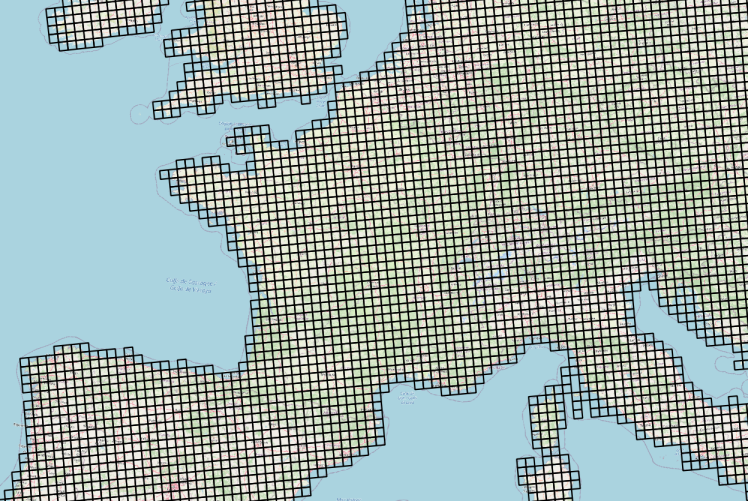
Meteorological observations from weather stations interpolated on a 25x25 km grid in France
Meteorological observations from weather stations interpolated on a 25x25 km grid, on a daily basis from 1979 to the last calendar year completed, for France.
Meteorological observations are freely accessible via OGC SensorThings Standard service : https://frost.geosas.fr/agri4cast/v1.0/
Observed properties :
- maximum air temperature (°C),
- minimum air temperature (°C),
- mean air temperature (°C),
- mean daily wind speed at 10m (m/s),
- vapour pressure (hPa),
- sum of precipitation (mm/day),
- potential evapotranspiration from a crop canopy (mm/day),
- total global radiation (KJ/m2/day),
More informations on Agri4cast Resources Portal : https://agri4cast.jrc.ec.europa.eu/DataPortal/Index.aspx
Simple
- Date (Publication)
- 2022-06-22
- Purpose
-
This Meteorological data access service has been deployed to simplify their integration into models and decision support tools. The driving idea is the co-construction of an ecosystem of digital services for open science based on the principles of FAIR data and the INSPIRE directive.
- Credit
-
Joint Research Centre of the European Commission
- Status
- On going
- Point of contact
-
Organisation name Individual name Electronic mail address Role UMR 1069 SAS INRAE - Institut Agro
GéoSAS
Distributor
- Keywords
-
-
open data
-
-
GEMET - INSPIRE themes, version 1.0
-
-
Elevation
-
- Access constraints
- Other restrictions
- Other constraints
- No limitations to public access
- Use limitation
-
Free use subject to mentioning the source : Source : Joint Research Centre of the European Commission
- Use limitation
-
Open licence. https://geosas.fr/metadata/pdf/ETALAB-Open-Licence-v2.0.pdf
- Use constraints
- License
- Other constraints
-
No limitations to public access
- Spatial representation type
- Vector
- Distance
- 25 km
- Language
- English
- Character set
- UTF8
- Topic category
-
- Geoscientific information
))
- Begin date
- 1979-01-01
- End date
- 2021-12-31
- Unique resource identifier
- RGF93 / Lambert-93 + NGF-IGN69 height (EPSG:5698)
- Distribution format
-
Name Version Shapefile
1.0
- OnLine resource
-
Protocol Linkage Name OGC:WMS
https://geosas.fr/geoserver/cipanhub/wms/ agri4cast_sensorthings
WWW:LINK-1.0-http--link
https://geosas.fr/agri4cast Interface de visualisation des données météo
WWW:DOWNLOAD-1.0-http--download
https://geosas.fr/geoserver/wfs?service=WFS&version=2.0.0&request=GetFeature&typeName=cipanhub:agri4cast_sensorthings&outputFormat=SHAPE-ZIP Couche géographique de la grille composée de mailles de 25km x 25km
OGC:STA https://frost.geosas.fr/agri4cast/v1.0/ Agri4cast OGC SensorThings service
- Hierarchy level
- Dataset
Conformance result
- Date (Publication)
- 2010-12-08
- Explanation
-
Article 7, paragraph 1, of Directive 2007/2 / EC corresponds to the technical procedures for interoperability: this is the regulation on interoperability: regulation n ° 1253/2013 of 21 October 2013 amending and supplementing Regulation n ° 1089/2010 of 23 November 2010
- Pass
- Yes
- Statement
-
Agri4cast Resources Portal. https://agri4cast.jrc.ec.europa.eu/DataPortal/Index.aspx
Metadata
- File identifier
- 643fcbf3-d890-4836-bf62-1204c043bc81 XML
- Metadata language
- Français
- Character set
- UTF8
- Hierarchy level
- Dataset
- Hierarchy level name
-
Parent
- Date stamp
- 2023-12-21T12:00:36
- Metadata standard name
-
ISO 19115
- Metadata standard version
-
1.0
- Metadata author
-
Organisation name Individual name Electronic mail address Role UMR 1069 SAS INRAE - Institut Agro
Service GéoSAS
Point of contact
- Other language
-
Language Character encoding English UTF8 French UTF8
Overviews
Spatial extent
Provided by