GeoDataINRAE
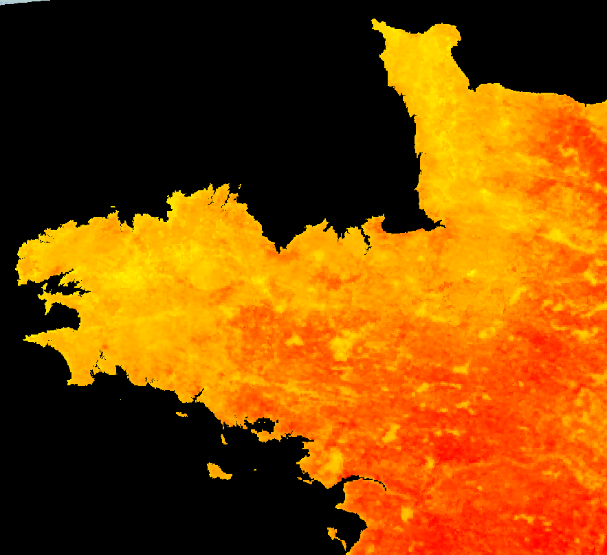
Température de jour (série temporelle) MODIS de la Bretagne
Température moyenne sur 8 jours par ciel clair sur la Bretagne de jour.
Simple
- Alternate title
-
TempJour MODIS Bretagne
- Date (Publication)
- 2017-07-07T09:00:00
- Edition
-
Continue
- Citation identifier
- fr-18007003900276-umrsas-psn-tempjour_modis_bretagne
- Purpose
-
Cette série temporelle d'images a été créée dans le but de rendre accessible la télédétection dans une IDS, mais aussi permettre de combiner cette information avec d'autres données dans un visualiseur pour affiner et optimiser des études, recherches, suivis, etc...
- Status
- On going
- Point of contact
-
Organisation name Individual name Electronic mail address Role UMR 1069 SAS INRA - Agrocampus Ouest
donatien,dallery
Originator
- Maintenance and update frequency
- Weekly
- Maintenance note
-
L'ajout d'une nouvelle date s'effectue tous les 7-9 jours en moyenne.
-
INSPIRE themes
-
-
Ortho-imagerie
-
- Keywords
-
-
Données ouvertes
-
-
GéoBretagne v 2.0
-
-
référentiels : imagerie
-
- Use limitation
-
Usage libre sous réserve des mentions obligatoires sur tout document de diffusion : "Source : UMR 1069 SAS INRA - Agrocampus Ouest / US 1106 InfoSol INRA"
- Use limitation
-
Licence ouverte : https://www.etalab.gouv.fr/licence-ouverte-open-licence
- Access constraints
- Other restrictions
- Use constraints
- License
- Other constraints
-
Pas de restriction d’accès public
- Spatial representation type
- Grid
- Distance
- 250 m
- Language
-
fre
- Topic category
-
- Environment
- Description
-
Série temporelle sur la Bretagne
))
- Reference system identifier
- RGF93 / Lambert-93 (EPSG:2154)
Distributor
- Distributor contact
-
Organisation name Individual name Electronic mail address Role UMR 1069 SAS INRA - Agrocampus Ouest
Pole GéoSAS
Distributor
- Distributor format
-
Name Version GeoTIFF
1.0
Digital transfer options
- OnLine resource
-
Protocol Linkage Name OGC:WMS
https://geosas.fr/geoserver/psn/wms?SERVICE=WMS&REQUEST=GetCapabilities tempjour_modis_bretagne
WWW:LINK-1.0-http--link
http://geowww.agrocampus-ouest.fr/sviewer/?wmc=b14385f696dfc8e1c7219891a180c745 WWW:LINK-1.0-http--link
https://geosas.fr/metadata/pdf/teledetection_metadata.pdf
- Hierarchy level
- Dataset
Conformance result
- Title
-
INSPIRE Data Specification for the spatial data theme Elevation
- Date (Publication)
- 2013-12-10
- Explanation
-
Non Evalué
- Pass
- No
- Statement
-
The MOD11A2 data product was retrieved from the online Data Pool, courtesy of the NASA EOSDIS Land Processes Distributed Active Archive Center (LP DAAC), USGS/Earth Resources Observation and Science (EROS) Center, Sioux Falls, South Dakota, https://e4ftl01.cr.usgs.gov/MOLT/.
Metadata
- File identifier
- 07ac3e4f-fbf1-4be2-ab67-43899c529313 XML
- Metadata language
-
fre
- Character set
- UTF8
- Hierarchy level
- Dataset
- Date stamp
- 2017-09-06T12:32:28
- Metadata standard name
-
ISO 19115
- Metadata standard version
-
1.0
- Metadata author
-
Organisation name Individual name Electronic mail address Role UMR 1069 SAS INRA - Agrocampus Ouest
Pole GéoSAS
Point of contact
)))